Polyline Layer
PolylineLayer draws lines on the ground: routes, borders, GPS traces. Polyline supports border strokes
(borderStrokeWidth draws a second, wider line beneath) and dash and dot patterns in logical pixels.
PolylineLayer(
polylines: [
Polyline(points: route, strokeWidth: 6, borderStrokeWidth: 3, borderColor: Color(0xFFFFFFFF)),
Polyline(points: detour, pattern: StrokePattern.dashed(segments: [12, 8])),
],
)
The demo draws the EU institutions as a GPS star: from the Commission in Brussels to the Parliament in Strasbourg, the Court of Justice in Luxembourg and the ECB in Frankfurt:
| Apple MapKit (iOS) | Google Maps (Android) |
|---|---|
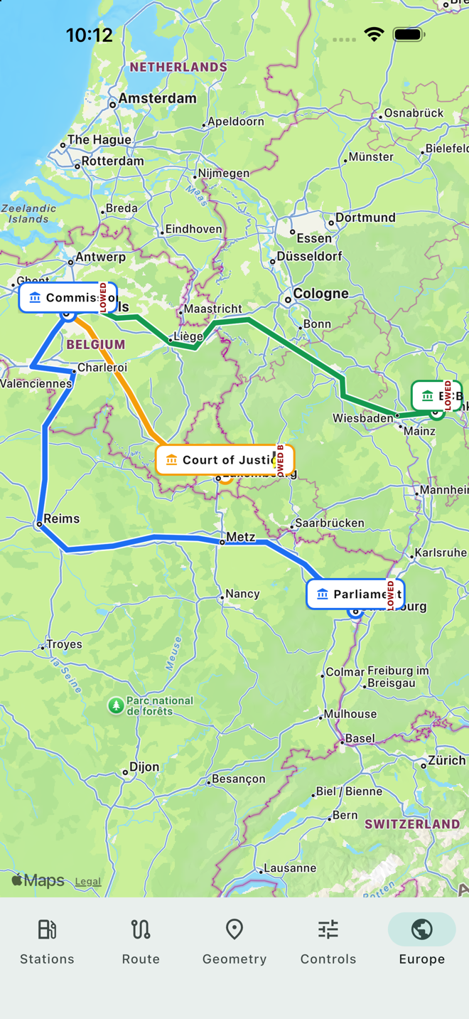 |  |